
The map below has an onscreen zoom function. It is supposed to show our current location (we are VK2DQC-15) and sometimes it even works (although it may take a few moments to display). Position your cursor anywhere over the map, then click on the "+" & "-" symbols on the left to zoom and un-zoom.
Try the satellite view as well.
Function Key F11 will expand to full screen for better viewing
Day 1, 9th May, No major problems, we are on our way. First stop Wellington (336klms - just a short hike to get in the groove for driving again). Wellington Valley Caravan Park was spot on. It was a nice caravan park with real grass. The town of Wellington blew me away because it is three or four times bigger than I remember it.
 Day 2, 10th May, Hell it was cold this morning.
It was less than 10 degrees again (that might be alright for ice
cream - but not so good for me). We got on the road by 8:30am
and had a good day for driving.
Day 2, 10th May, Hell it was cold this morning.
It was less than 10 degrees again (that might be alright for ice
cream - but not so good for me). We got on the road by 8:30am
and had a good day for driving.
On this stretch we saw emus, a fox, merino sheep, black cows with yellow ear-rings, a dingo and wild goats. Not bad for one day.
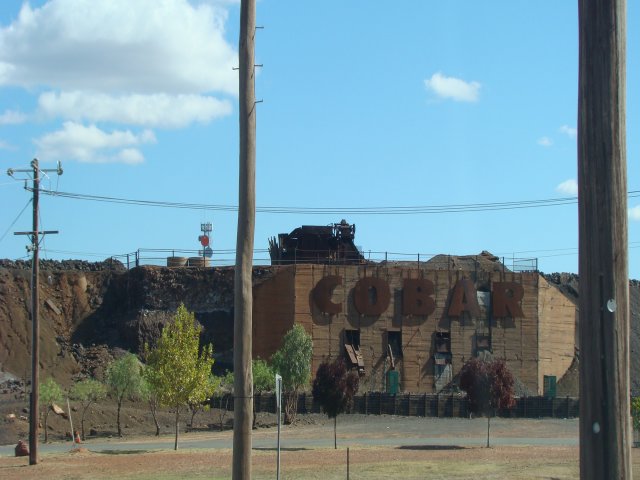
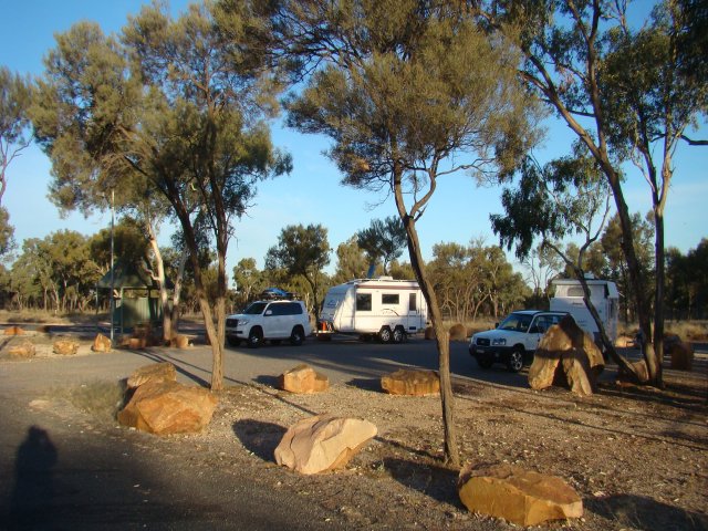
That "ugly strange thing" (right) is at the edge of the town of Cobar and can't be missed - someone tell me what it is! We drove 532 klms today and almost reached Wilcannia. We stopped at the roadside rest area (below left) about 60 klms before (east of) Wilcannia.
< choose another part of the 2011 trip >
< choose the trip from another year >
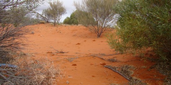
That place was so dark and quiet and spooky at night, that I was frightened ..

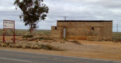 Day
3, 11th May. Crossing the border into South Australia was an eye opener - the
road suddenly got lumpy and rough. We should have slowed down a little but I was
bored and kept going at about 100 k/h. One of the towns we passed through was ON
the NSW/SA border. It was called Cockburn and reminded me of Charlie Sheen for
some reason ? It was quite a small place and I just had to take a picture of the
town centre (right).
Day
3, 11th May. Crossing the border into South Australia was an eye opener - the
road suddenly got lumpy and rough. We should have slowed down a little but I was
bored and kept going at about 100 k/h. One of the towns we passed through was ON
the NSW/SA border. It was called Cockburn and reminded me of Charlie Sheen for
some reason ? It was quite a small place and I just had to take a picture of the
town centre (right).
Yunta was the next overnight stop for us. We chose Yunta because .. ? I don't know why, we just stopped, and noted the day's mileage was 449 klms.
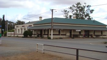
The woman in the post office was a bit agro because I parked in the post office parking area and it was feasible that a customer could turn up before the end of the week!!!!
I decided to take a picture of the hotel (left), instead of the post office with the grumpy proprietor.
Total so far 1319 kilometers, punctures zero, road kill zero.
Day 4, 12th May. The road trains and semi trailers didn't annoy me today and so I had an easy day. We only travelled as far as Port Augusta (220 klm) where we topped up with fuel and did some grocery shopping.
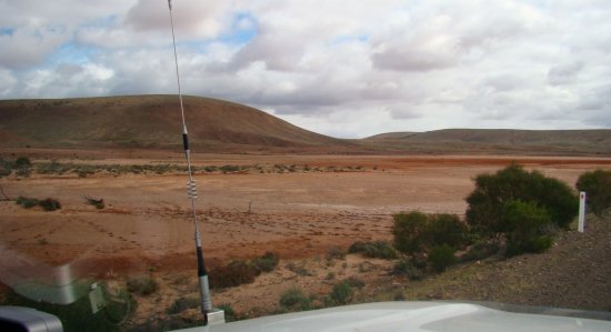
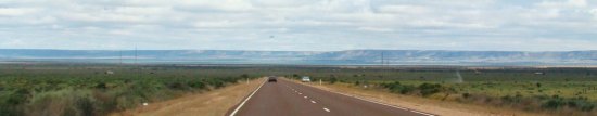 The
landscape (right) was quite barren until we got closer to Perterborough, but at
least there was some green patches.
The
landscape (right) was quite barren until we got closer to Perterborough, but at
least there was some green patches.
< choose another part of the 2011 trip >
< choose the trip from another year >
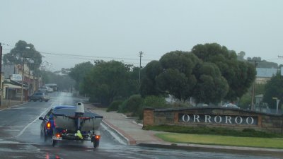
I have to wonder if the white settlers understood exactly what the aboriginal people were saying when they told us the names of some of their places. Did he say Ororoo (left), or did he say "I wanna borrow your shoe"!
Tomorrow we will be heading directly North towards Alice Springs, but there's not much chance of going that far! I can't guess where we might stay tomorrow night. Because of this we decided to stop tonight in a caravan park right here in Port Augusta. This gives us a chance to fill our water tanks - we are down to our last 50 litres. The park owners even said we could use their water to wash our car and caravan - this was unheard of in previous years.
 I
have been told that a place cannot be called a "city" - unless it has a ... ? ... ? (what was
it ?).
I
have been told that a place cannot be called a "city" - unless it has a ... ? ... ? (what was
it ?).
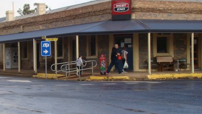
Anyway in Australia, a place doesn't get a name at all... if there isn't a pub. This one is in Ororoo.
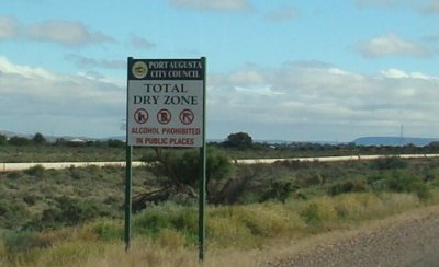
Warning ! dont stand in a Port Augusta street with a beer, or anything alcoholic (left). By order of the city council.
Total so far, 1539 kilometers, punctures zero, pedestrians zero, post office proprietors one.
Day 5, 13th May, Bugger, My Toyota Landcruiser is broke. There's a problem with the computer that runs the whole car. All the warning lights on the dash are illuminated and the car is in "limp" mode (max 10 kph). It has happened twice before and I had previously blamed my radio (the one that transmits my gps location). I crawled to the local Toyota dealer and waited for an hour to get a mechanic. He cleared the fault and suggested that it was more likely caused by an intermittent fault in the turbo stepper motor. It may actually be a warranty claim when I get back to Sydney - If I get back to Sydney (at 10 kph I would get home sometime in 2012). We finally got on the road after midday.
As we drove further north towards Glendambo I realized that the earth was turning bright red (left), but there is still plenty of green vegetation. The landscape has never looked this good in any of our previous trips along this part of the country.
When we cleared the small sand dunes, the bigger ones became more visible and so did the salt pans (right). It is so long since they had water in them that the salt is now covered with a layer of red sand.
< choose another part of the 2011 trip >
< choose the trip from another year >
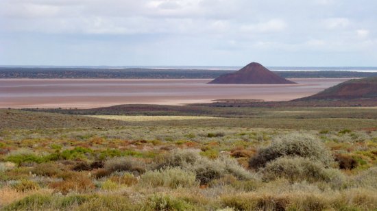
That lake on the left is not a lake! (most of the time it's a salt pan). It appears to be full of water but it's dry. If you move to this part of the country, you won't need an umbrella.
Total so far, 1895 kilometers, punctures zero, breakdowns 1.
Day 6, 14th May, We were briefly within telephone range today (yes, even Telstra is scarce out here). Anyway it was nice to get an email from "Joe Schembri" in Malta - he is watching our travels too. It is a coincidence that one of Connie's sons is also "Joe Schembri" and this caused a few moments of confusion :-) Hello to Joe in Malta. Our travels today took us 539 klms closer to the Northern territory border. I think it is only 50 klms or so up the road.
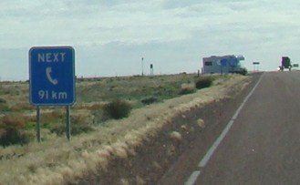
When I look at some of our road signs, I wonder what people in
other countries must think, especially when I see signs like these...
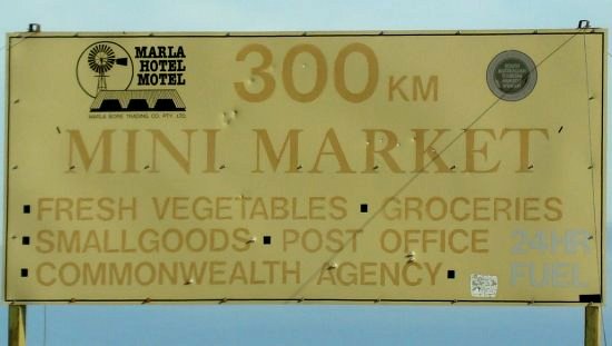
"Next phone 91 km" and "300 km to the Mini Market"
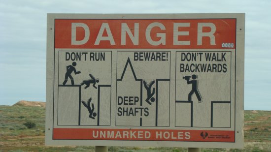
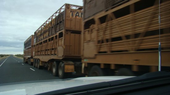
The Coober Pedy opal mines are dangerous if you wander off the beaten track. The holes in the ground are roughly 100 feet deep and 3 feet across, so be careful (lower left) - they do not have rails or fences around them! And don't get in the way of these monster "road trains" either - they are huge. (lower right)
Total so far, 2435 kilometers, punctures zero, breakdowns 1.
Day 7, 15th May, Forever forward .... on .. and on ... and on ... Alice Springs here we come !
< choose another part of the 2011 trip >
< choose the trip from another year >