Part Four
Function Key F11 will expand to full screen for better viewing
The map below has an onscreen zoom function. Position your cursor over the map - then click on the "+" & "-" symbols on the left to zoom and un-zoom. Try the satellite view as well.
If you have been looking at the map on each page, you probably are wondering why we have stayed at Cutta Cutta for so long. Well, to cut a long story short, the APRS stopped working at Cutta Cutta. I'm taking the APRS radio out of the car and putting it into the caravan. My location signals have not been received (by the APRS system) since we left Cutta Cutta. The transmitted radio signals may possibly be the cause of my woes with the Landcruiser computer. The map above, is a result of having the radio in the caravan - looks like it now works better.
PS. I have found something that Toyota don't know (or didn't want to tell me). The computer is reset when both batteries in the Landcruiser are disconnected for a short time (20 seconds doesn't seem to upset the radio/cd player).
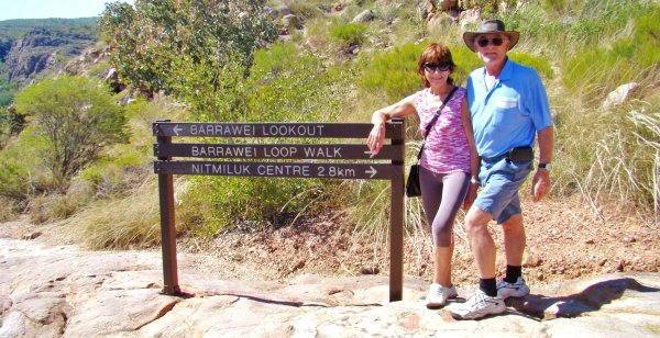
31st May, today we did our part to conserve energy - we walked, climbed, and crawled up to the Barrawei Lookout.
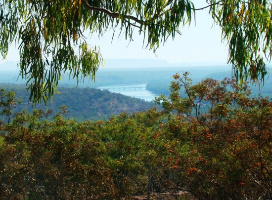
To be precise, we drove to Katherine Gorge and then walked 28 km up to the lookout from the Nitmiluk Centre(left).
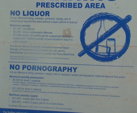
That IS what the sign says, isn't it?
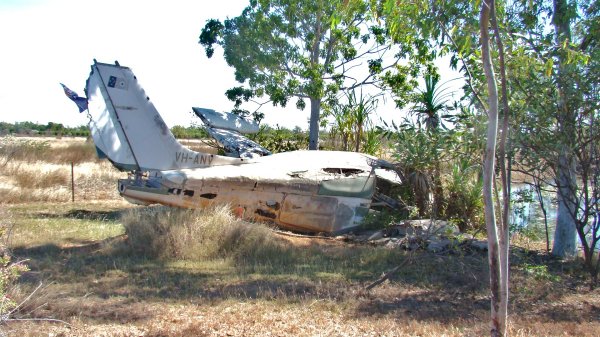
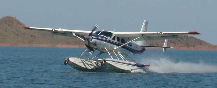
Along the road to Katherine Gorge we noticed a variety of small airways offering scenic flights over the gorge. There were some rather expensive ones... .... and some bargain priced ones (left) but they didn't look too safe to me.
 6th
June, You probably thought we had fallen off the other side of the planet, but
no, we are still here in Katherine and my drivers license finally turned up this
morning. We'll be moving on again tomorrow morning.
6th
June, You probably thought we had fallen off the other side of the planet, but
no, we are still here in Katherine and my drivers license finally turned up this
morning. We'll be moving on again tomorrow morning.
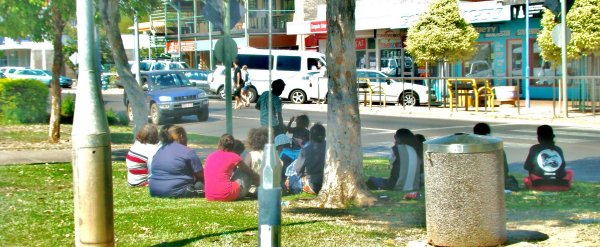
As we killed time walking and driving about the town, I thought this picture (right) was quite typical of this part of the country. The aboriginals meet, eat and drink wherever they are comfortable. Here they are - on the island in the middle of the main street in Katherine - soooo relaaaaaxed.
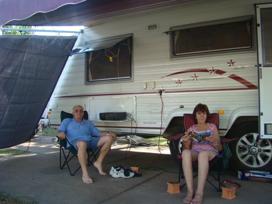
Then again, we have our way of "taking it easy". The weather has been great!
Total kilometers when leaving Katherine 4,411 klm
7th June, Start peddling Connie, let's head for Lake Argyle. We'll stop somewhere (about half) way for the night. The first thing that caught my eye was a team of stockmen on horseback with a small herd (about 200) cattle they were moving along in a small paddock beside the road - the paddock would have been about 800 square kilometers. My camera was too slow for the shot - sorry.
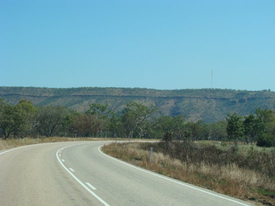
When I look at escarpments like the ones here (left & right) I wonder at the layers of rock. Each one shows where the seabed used to be - just before I was born !!!

At one point (below left) I almost had to turn back, until I spotted a technicality that would allow me to continue. This termite mound (lower right) also intrigued me - and NO, I was not having a pee!

We settled for the night at the top of a lookout just past Victoria River and the view from our caravan window (right) could not be better. We really were as high as this picture makes it look... er "high" ... no, not hat sort of high.
The climb up to this lookout was steep and the Landcruiser had to change down a gear. I was amazed to see that a Nissan Patrol also made it up the climb - in first gear, I suspect!
< choose another part of the 2011 trip >
< choose the trip from another year >
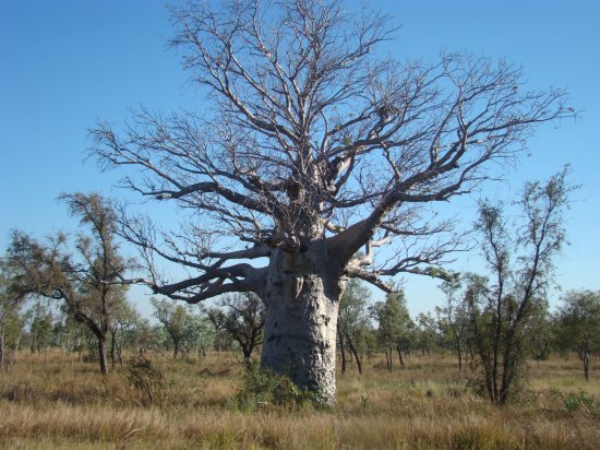
8th June, we slept all night (at the top of the mountain) with the door and all the windows wide open. It was still comfortably warm at breakfast. We headed off towards Lake Argyle and soon realized that we were entering the "Boab Tree" country (right).

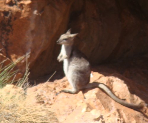
We also realized that the kangaroos don't understand daylight saving - they seemed to be out much later than they were supposed to (left).
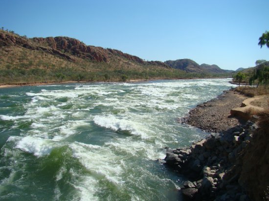
As we approached the Lake Argyle Village, we were surprised by the speed and ferocity of the water flowing from the one of the minor spillways (right) of the Ord River dam.
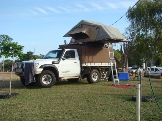
At the village I almost had a punch up with the guy next door (left) who chose an "unpowered site" - but then kept his 4 x 4 diesel engine running to keep his fridge cold!
Connie started the fight by trying to beat him up - I finished it by beating up one of his kids.
< choose another part of the 2011 trip >
< choose the trip from another year >
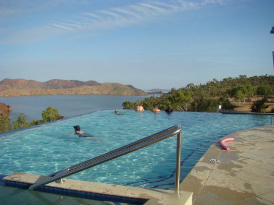
The camping area turned out to be brilliant with plenty of grass, a magnificent pool (right) .. that overlooked the lake. They even had trees for my antennas.
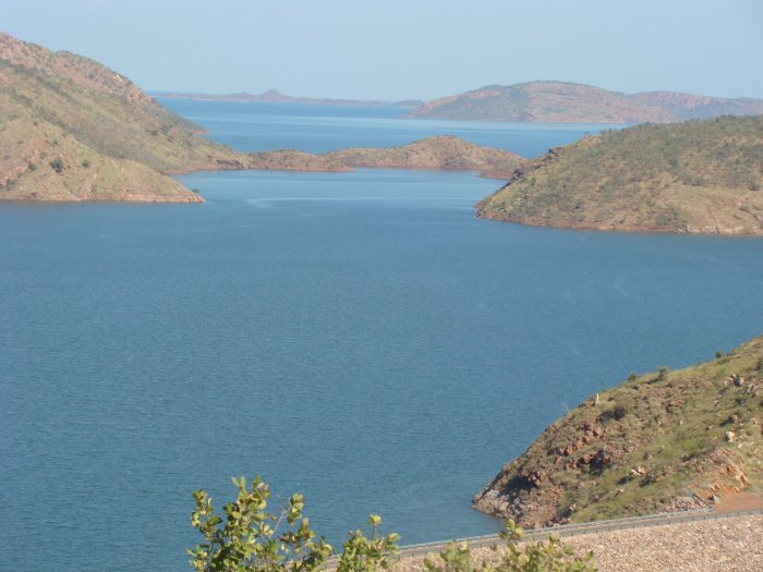
9th June, A cruise on the lake (left) was a real eye-opener. I've flown over it but I still hadn't fully appreciated the size until now. This picture shows about 2% of it. Our commentator told us that the lake currently is the equivalent of "54 Sydney Harbours". If it fills to maximum capacity that number of "Sydney Harbours" goes up to 84.
I don't like using "my harbour" as a measuring cup - so I felt justified in helping myself to two morning teas on the boat, and Connie even had three pieces of fruit cake !
BELEIVE IT OR NOT ... the dam in the lower right corner has NO CONCRETE in it. It was built from local granite, and clay.
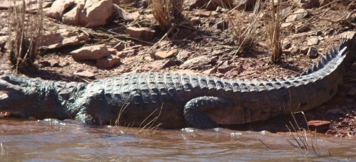
The critters that live around it, don't care what the dam is made of as long as the general traffic (lower right) keeps to itself.
< choose another part of the 2011 trip >
< choose the trip from another year >