click this →
![]() ←
If you see this
←
If you see this
click this →
![]()
Winter 2012 - Including Normanton to Cairns
Index Page (& map)
 This trip was turned upside down by a
<"prematurely delivered"> caravan
(that's the nicest way I can describe it).
This trip NOW looks like this ... Lightning Ridge, St George, (as we get bits of the
caravan repaired or replaced), Toowoomba, Bundaberg, Calliope, Yaamba, St
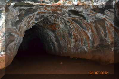
Lawrence, MacKay, Proserpine, Home Hill, Townsville, Mount Surprise, Cobbold Gorge, Undara Lava Tubes, Mount Surprise,
Normanton, Burke & Wills Roadhouse, Cloncurry, Boulia, Windora,
Eromanga, Thargomindah, Eulo, Cunnamulla, St George, Moree .... that's until we
change it again.
This trip was turned upside down by a
<"prematurely delivered"> caravan
(that's the nicest way I can describe it).
This trip NOW looks like this ... Lightning Ridge, St George, (as we get bits of the
caravan repaired or replaced), Toowoomba, Bundaberg, Calliope, Yaamba, St
Lawrence, MacKay, Proserpine, Home Hill, Townsville, Mount Surprise, Cobbold Gorge, Undara Lava Tubes, Mount Surprise,
Normanton, Burke & Wills Roadhouse, Cloncurry, Boulia, Windora,
Eromanga, Thargomindah, Eulo, Cunnamulla, St George, Moree .... that's until we
change it again.
At the end of May we'll load the van and move out of the house so that the new owners can finally move in. If you wait a few moments, the map below will show our exact whereabouts right now! Our GPS location is continuously updated on this map. The map has a zoom function ( +/- top left of map) and a satellite/map option (click on "MAP" top right corner). ... it often works! :-))
The map below has an onscreen zoom function. Position your cursor over the map - then click on the "+" & "-" symbols on the left to zoom and un-zoom. Try the satellite view as well.
"click the pic" or
the label to see the pics & news during that part of our trip!
< Another year >
< Index page (& map) >
< Part 1 >
< 2 > < 3 >
< 4 > < 5 >
< 6
> < 7 > < 8 >
< 9 > < 10 >
< 11 > < 12 >
< 13 > < 14 >
< 15 >
< Part 1. Sydney to Toowoomba >
< Part 2. Toowoomba to Calliope >
< Part 4. Rockhampton to Home Hill >
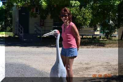
I have just been discussing the weather with my friend here ...
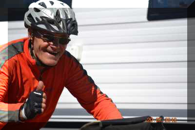
From Germany !!!!!!! on a bike !!!!! now that's a surprise.

< Part 9. Croydon to Normanton >
< Part 10. Normanton to Cloncurry >

< Part 13. Longreach to Blackall >
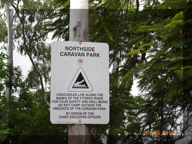
(This is what happens when an area is designated for free camping)
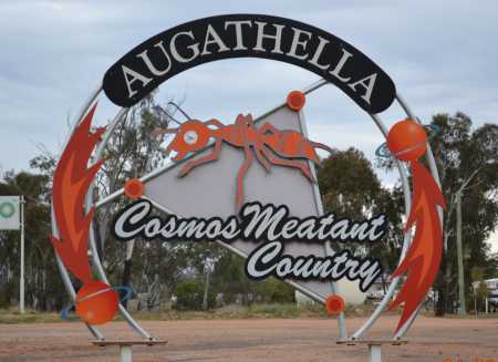
< Part 14. Augathella to Cunnamulla >
< Part 15. Bourke and then home >
< Another year >
< Index page (& map) >
< Part 1 >
< 2 > < 3 >
< 4 > < 5 >
< 6 > < 7 >
< 8 >
< 9 > < 10 >
< 11 > < 12 >
< 13 > < 14 >
< 15 >